Walking the Devil’s Ditch
The Devil’s Ditch (Ördög-árok) is Budapest’s most storied stream. It gained its name due to a combination of medieval superstition, its unpredictable and destructive nature, and local legends. Its ‘diabolical nature’ certainly relates to a history of flooding, as the stream’s water levels were highly volatile in the past. Sudden and destructive floods have been experienced periodically along its length. People in the Middle Ages believed only the devil could create such rapid damage, prompting the nickname.
The Devil’s Ditch rises about twelve miles to the west of the city in the Buda Hills. The idea was to walk it in one day. Well, that didn’t happen, and time constraints meant that it took three separate walks this spring to get from the source to the confluence with the Danube in the heart of Budapest. So much for the best-laid plans!
Our idea on day one was to find the source and then head back towards the capital. Easier said than done! The map showed the árok rising in the hills just outside of Nagykovácsi. Well, we found it on the edge of the town, disappearing under a bridge into a scraggy area full of stunted young trees and old broken ones, their trunks sometimes split into four for some reason. Possibly the devil’s work? Or maybe storm damage? Either way, the stream bed was completely dry. The route was impossible to get through because of the dense vegetation, and we turned back and followed the route into the town. At this point it should be noted that the word 'árok' means 'ditch', and that was exactly what it was.
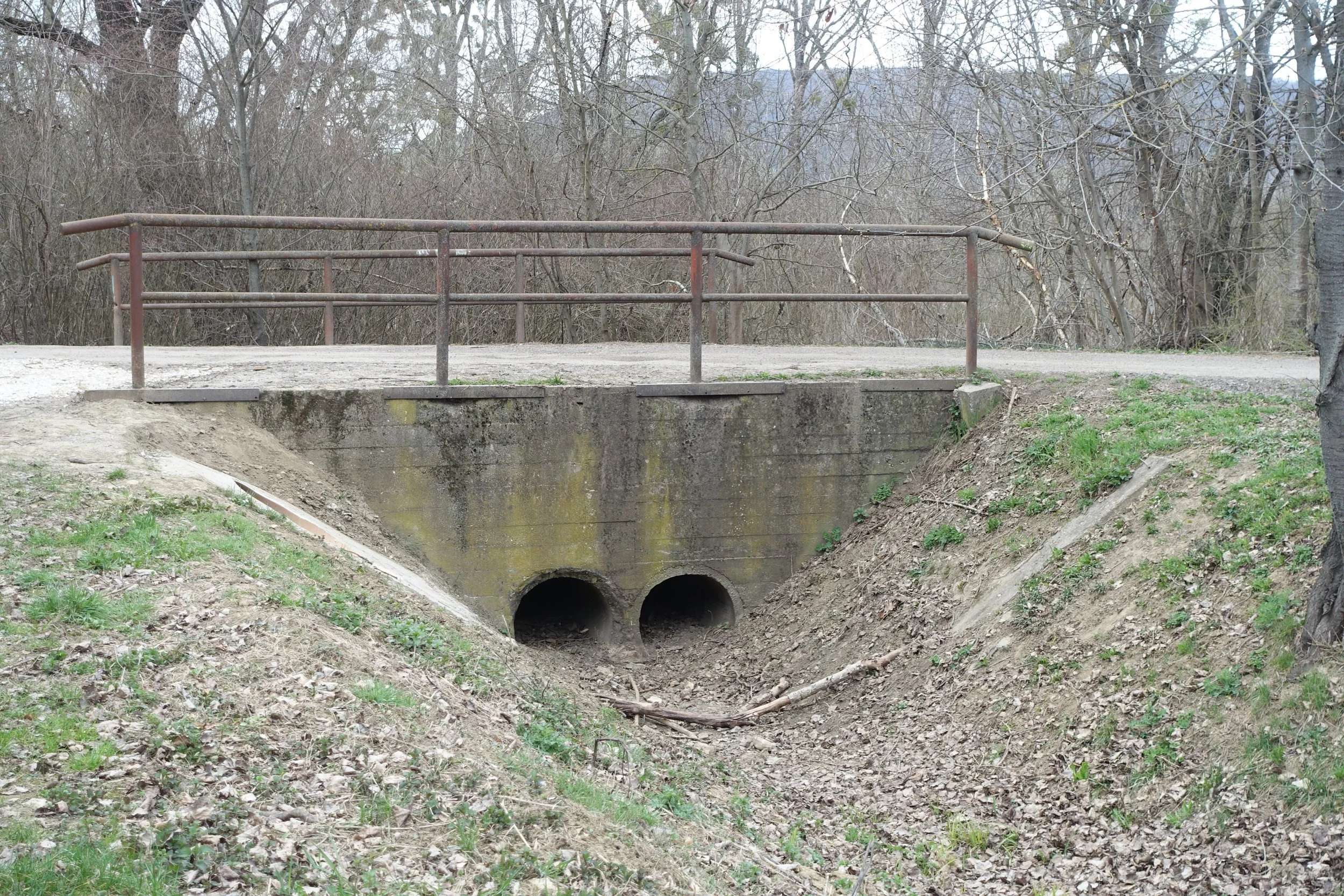
The shrivelled up Ördög-árok in the Nagykovácsi basin.
Nagykovácsi was once a village but has grown over time to become a small commuter settlement. After a hundred metres, water suddenly became visible in the stream bed. I feared it was from sewage outflows, but the water was clear and odour-free. It must have been from tributaries and maybe springs along the way. We encountered a bridge with unusual statues on either side. One was a commemoration of the Swabian (Germanic) people who were resettled in Hungary in the eighteenth century following depopulation during Ottoman rule. They came from as far away as the Black Forest and were well established here until the end of World War Two.
At this point the Beneš decrees came into play, and most of the Swabian community were deported to southern Germany under the auspices of the Soviet Union. They were replaced with Hungarians from the 'Felvidék' – that part of ‘Upper' Hungary which had become Slovakia after the First World War. Such is the legacy of these historical events that the Fico government in Slovakia passed legislation in December 2025 which prohibits any questioning of the post-war expulsion of ethnic Hungarians and the confiscation of their property. A six-month prison sentence awaits transgressors in Slovakia. In support of the Hungarian minority community, the new Prime Minister, Péter Magyar, has promised to get the Slovakians to repeal this legislation.
The statue on the other side of the bridge showed a tree cut in half but with a strong root system, symbolising the strength of the Swabian people. History in this part of the world can be extremely complicated and is always contested by someone.
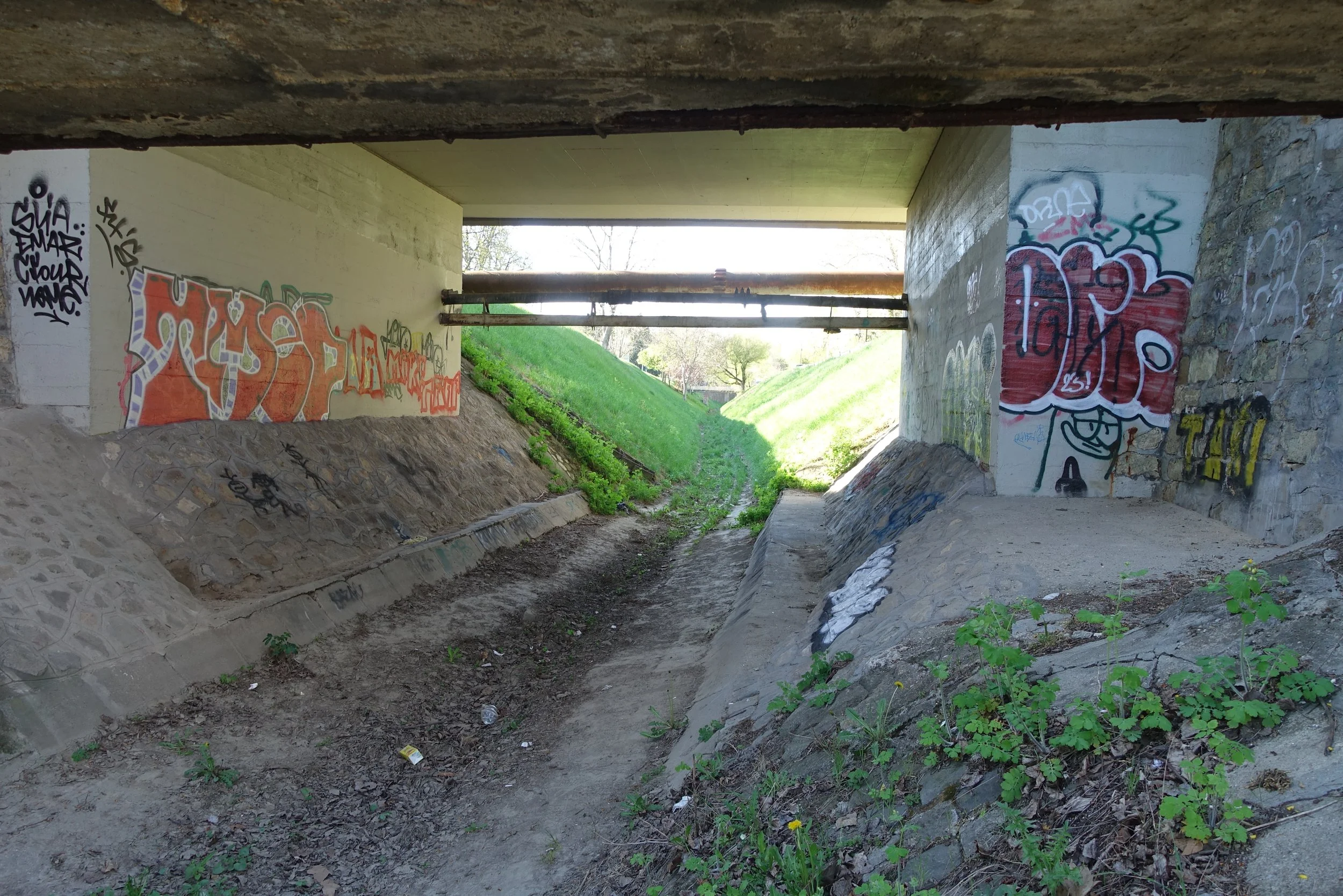
Signs that the ‘árok' still offers a threat.
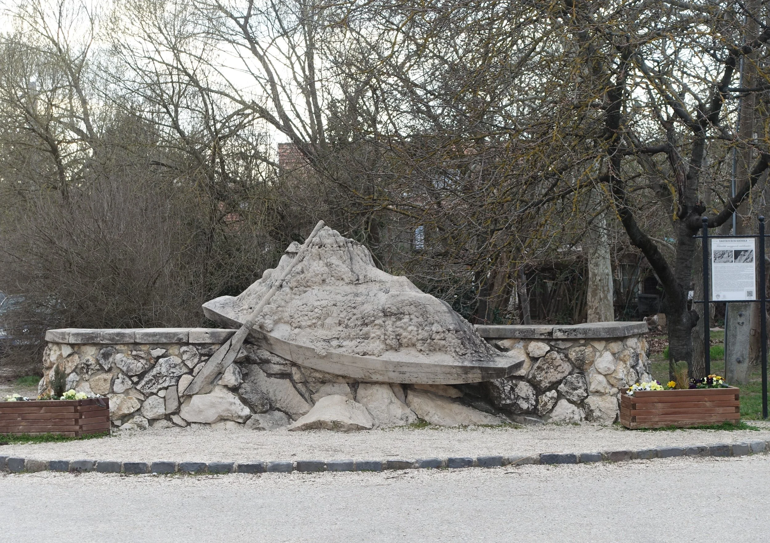
Sculpture about the plight of the Swabian people.
Our route out of Nagykovácsi was blocked as the stream entered private property. We took a diversion along a footpath and tried to work our way back to the 'árok', which eventually we did. Unfortunately, the stream, still flowing at this point, passed under the main road and into more scraggy private property. The footpath faded out as we tried to find a way south. Our only prospect of rejoining the stream was to follow a curvy, high-traffic road without a pavement. The bus was a safer option. I was able to catch glimpses of the árok in the distance, from the bus window, but it mostly passed through private, forested land descending towards the capital.
Hűvösvölgy is at one hilly edge of Budapest and a terminus of the local transport system. We stopped for a quick break at an unlikely-looking café near the tram line. Boxing from the USA played on the television screen, and afternoon viewers drank beer. We enjoyed refreshing tea in this clean and friendly establishment before picking up the dry river on the edge of a deep, hilly forest. We walked above the árok as the afternoon faded. Mountain bikers scurried past, and a family enjoyed a bonfire on the edge of the tree line. We could see the ditch at the very bottom of the hill, with branches and leaves filling the space that water sometimes occupies. Only the sound of trams predicted that we were entering the city.
The árok became contained in a wide and deep trough, suggesting that when rain falls heavily there is a substantial flood risk. At the bottom of steep hills here, we entered the urban area proper. In Pasarét (Pasa's field) we walked parallel to the trough through Napraforgó Utca. This street was the centrepiece of an architectural competition in 1931 celebrating the Bauhaus movement. Each house was designed by a different architect, and the properties retain their individuality and style. The tree-lined street emits a pleasant ambiance. At the next junction the árok again veered off into private land, and we took a diversion to Pasarét Square, passing its modernist Franciscan church. From there it was a short detour to where again we could walk alongside the árok, parallel to the tram route.
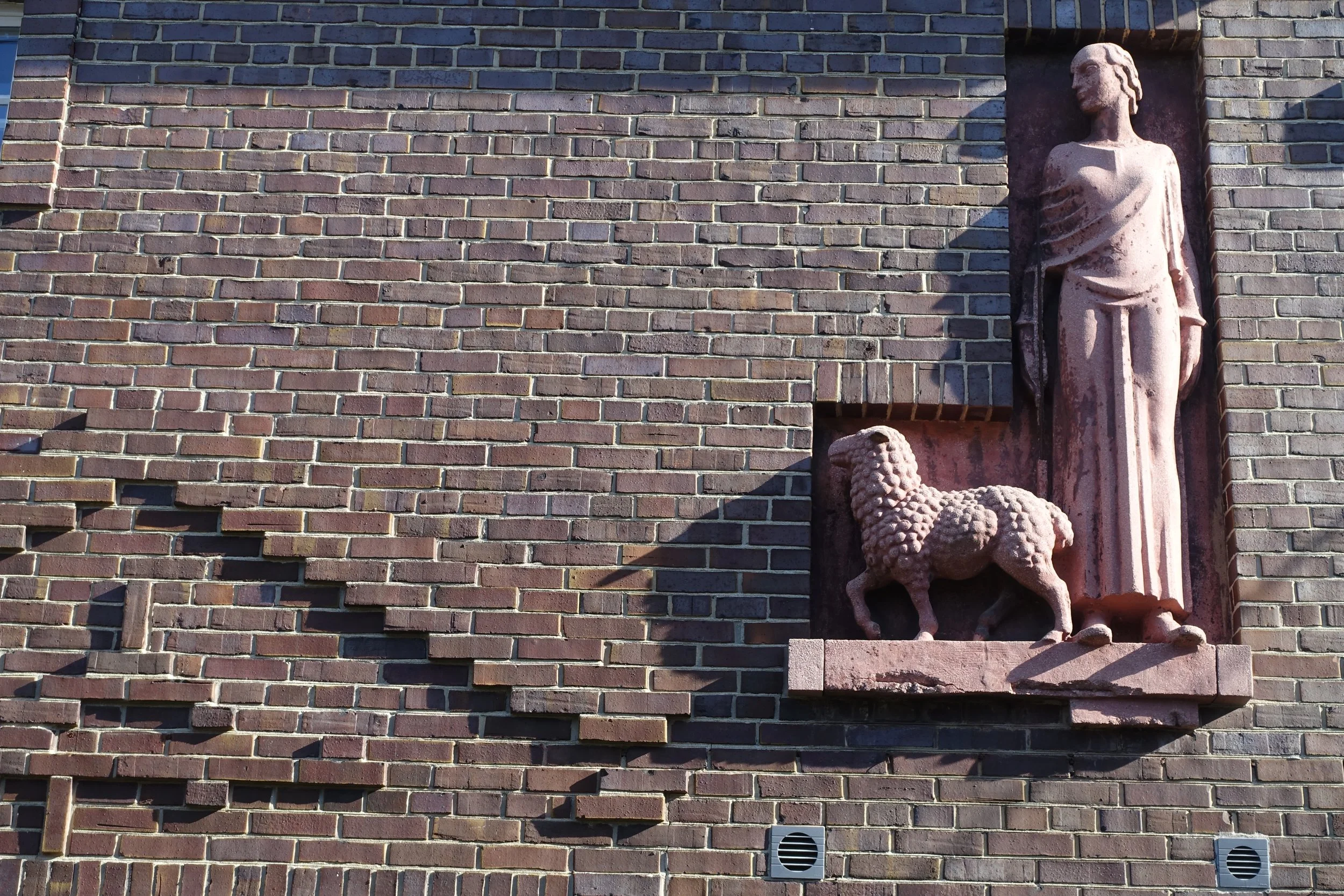
Scene of a pastoral nature on a Bauhaus building in Napraforgó Utca.
Evening had descended, and my knees were beginning to ache. Time to stop walking. A mountain biker climbed on the tram with us and was almost immediately reproached by a recorded message saying that bikes weren’t allowed on the vehicle. The driver left his cabin to order the young man off. The offender said he was tired and could not cycle to the end of the earth. Other passengers spoke up for him, saying he wasn’t in the way on a quiet Sunday evening. He was allowed to remain and rest his tired limbs. We went to devour some delicious Vietnamese food hungrily. The first part of the Ördög-árok walk was completed.
My wife being unavailable, I walked the second afternoon alone, picking up from the concluding point of the first day. The stream remained dry and followed the main road and suburban tram tracks. At Akadémia, near the former military college, the árok disappeared into a culvert. Like the Fleet in London, the river became part of the city’s sewage system, transporting raw material down to the Danube. This was done between 1873 and 1876. A modern piping system was built in the 1970s, taking Buda’s sewage to Csepel Island for processing in the south of Budapest . Now the culvert acts primarily as part of the city’s flood prevention system. Not that there are very many floods.
The árok in Pasarét close to where it is culverted.
Strangely, there was the sound of running water from the tunnelled area. Whether it was sewage or streams joining from the surrounding hillside wasn’t clear. Beyond here, the fence alongside the hidden river is decorated with paintings of the heroes of the 1956 uprising. Particularly, those Buda residents who were significant in the events. The afternoon suddenly became warm, and I carried my jacket past the expensive Budagyöngye shopping centre – a small but upmarket place reflecting the general affluence of this part of the city.
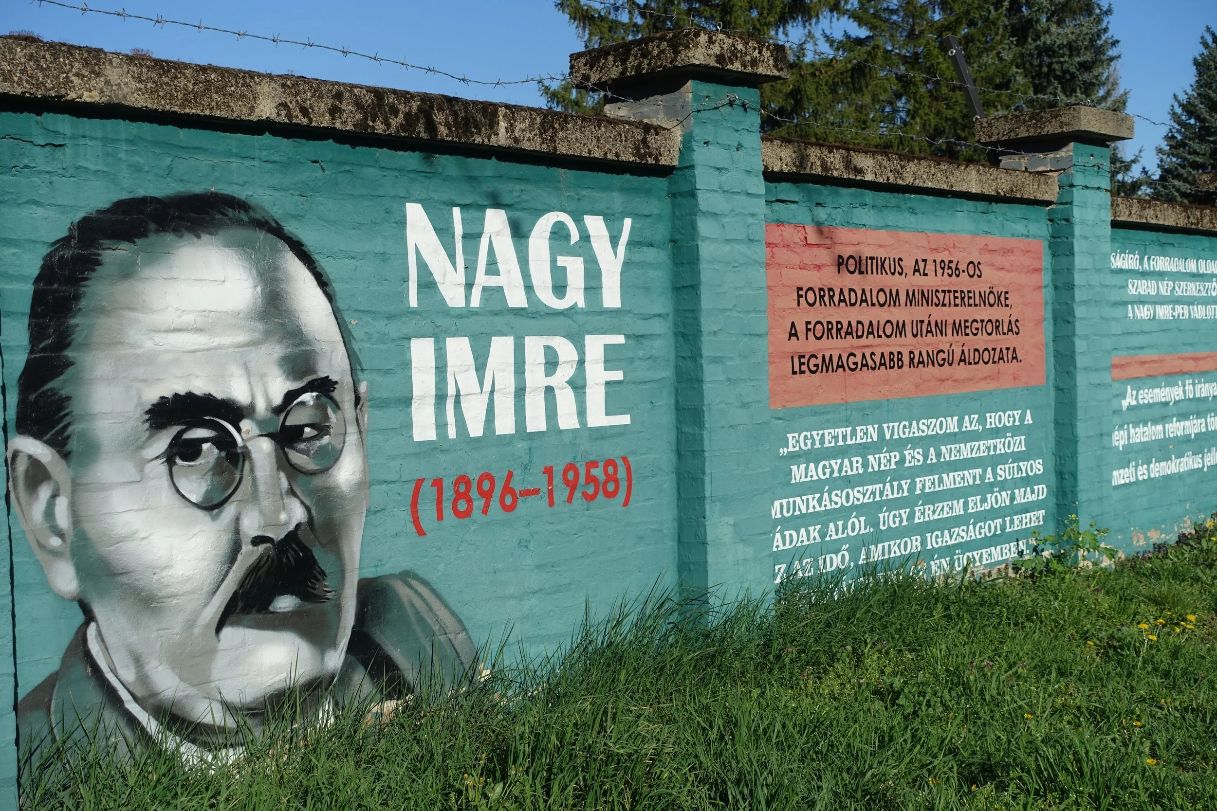
Buda resident Nagy Imre who became the leader of the 1956 uprising against the Soviet Union.
There was a space between the pavement and the tram tracks under which the culvert continued. The árok runs somewhere under the complex traffic intersection at St John's Hospital then swings south under Városmajor Park. This is the city’s oldest park. Previously, there were pleasure gardens here and fairs. Now it is a pleasant space with free sports facilities – an outdoor gym, five-a-side football pitches and basketball courts. The trees are abundant, and about 10 per cent were removed this spring to allow more light into the area. Most trees date from after 1945, as this was the scene of savage fighting during WW2 when German and Hungarian troops held up the Russian advance for several weeks.
There are no signs above ground here of the árok's exact route until you reach the unusual architecture of the 1930s Városmajor Catholic church, built long after the Ördög-árok was culverted. The route of the árok can be identified here because the huge steeple had to be built separately to the main church as the land nearby was weakened by the passage of the underground river. I cannot decide if I like the architecture of this particular church. Living nearby, I have grown used to its high steeple and bells ringing at noon. All churches in Hungary ring the bells daily at this time, in memory of the victory of Hungarian forces over the Ottoman Empire at the Siege of Belgrade (known as Nándorfehérvár in Hungarian) in 1456. As you can see, old traditions die hard here. I was overdressed for the warm day and growing hungry, so I took the easy option and stopped the day’s walk at this point.
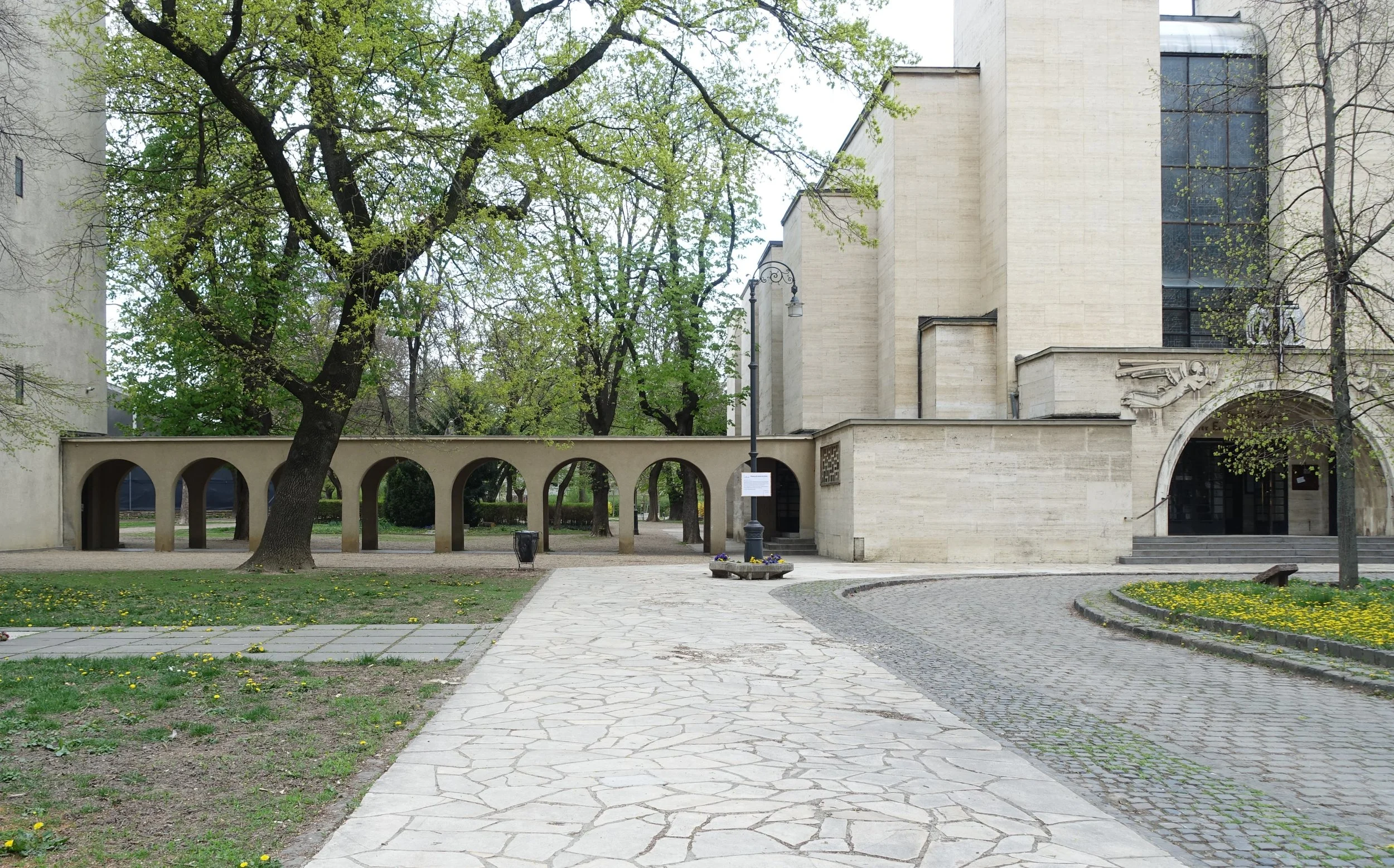
Városmajor church- the route of the árok is somewhere underneath the arches.
I picked up the route again on another warm day, opposite the church. The 'árok' ‘flows’ under Maros Utca, a pleasant street now with an eclectic range of architecture. In the winter of 1945, it was the scene of Arrow Cross atrocities committed against the patients of a Jewish hospital, where the victims were buried in the courtyard. This was one of several incidents in the neighbourhood as the Hungarian ‘Nazis’ continued their butchery that freezing winter, despite the fact that the Russian forces were only a few hundred metres away. Today the building is still used by the local health services.
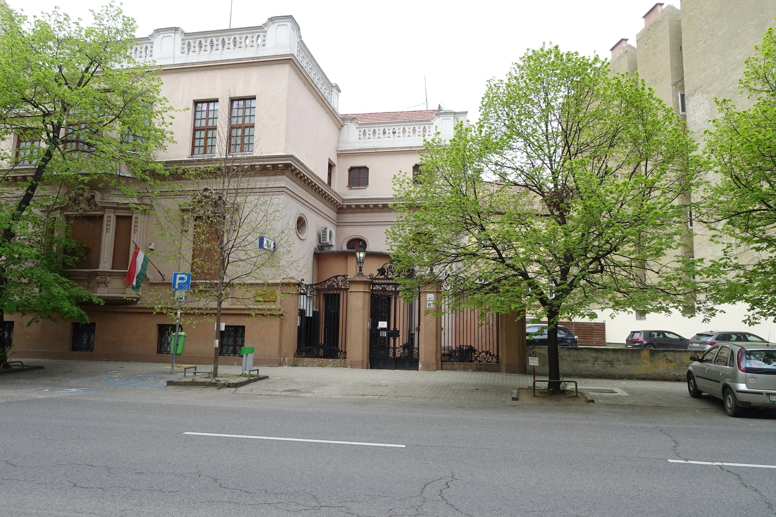
Scene of Arrow Cross atrocities during the winter of 1945.
The river crosses another major traffic intersection and follows a route through or next to Vérmezö (Blood Meadow). This is an urban park running parallel to the castle plateau, a dusty corridor in the valley of the Ördög-árok, between two busy roads but pleasant enough. I identified where the ground was lowest to estimate where the original river would have run. During the later stages of WW2 German gliders landed here to supply the troops under siege in the castle above. I only saw a scattering of dog walkers and some park bench drinkers who had probably migrated from the nearby Southern Railway terminal.
The árok left the park and 'flows' under an ugly ten-storey building, out of place with lower-level structures in the neighbourhood. I know there have been discussions about pulling down this eyesore. The nearby Dobay Cukrászda was a fine cafe to stop for a break, with its outdoor seating looking onto a statue of the famous Hungarian opera singer and actress, Déryné. The Dobey is reasonably priced with excellent malty tea and good cakes. Other cafes and restaurants around here are much more expensive. The internationally known Hungarian author Sándor Márai (of ‘Embers’ fame) lived locally. Several Hollywood A-listers have apartments in this discreet neighbourhood, well away from the tourist hoards, but are occasionally spotted dining nearby.
Continuing in a south-easterly direction, I entered the Tabán. The river has played an important role in this district’s history. In 1838 the árok still ran overground here and flooded ferociously, destroying many properties. A statue to St John of Nepomuk stands in memory of this event. As patron saint against floods and drowning, he offers protection against future watery calamities. Bordering the Danube, the Tabán was a poor, cosmopolitan area with many Serbian and Greek sailors resident until the 1930s, when most residential properties in the area were demolished.
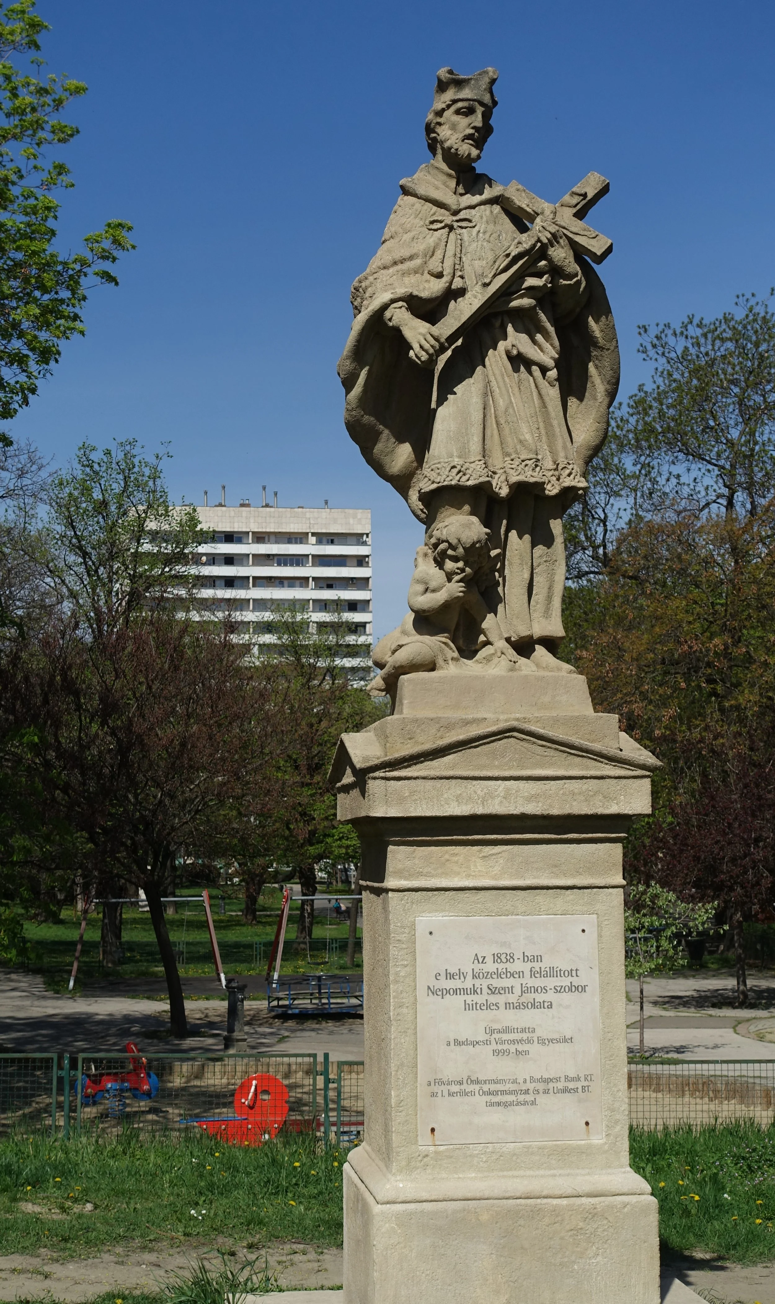
Statue of St John of Nepomuk.
It was here, near the statue, in February 1945 that the German and Hungarian high command leaders attempted to escape the invading Russians by climbing down into the culverted river. They were followed by about 1300 troops of lower ranks. Their idea was to follow the árok north underground and then escape into the Buda Hills, connecting with German forces further west. Everywhere the escapees attempted to leave the culvert there were Russian troops waiting. Possibly they had been betrayed, although there is little evidence to suggest that was the case. After thirty-six hours of marching up and down stream in the rising water, they left the tunnel close to where they originally entered and were immediately captured. Most of the German and Hungarian high command were subsequently executed by the occupying Soviet forces.*
Tabán today is full of roads, tram lines and tourists, although it remains a pleasant area with green spaces. A mediaeval bridge still stands over the route of the buried stream, and there is a strange sunken area, which may have some connection with the management of the árok’s 'flow'. Quite by chance, I encountered a former engineer nearby a couple of years ago, who was long retired but had told me he had had the opportunity through his work to walk the length of the culverted stretch of the river at some point during the 1980s. Although he seemed to enjoy the walk, he remarked on smells from the old sewage works and a number of large rats.
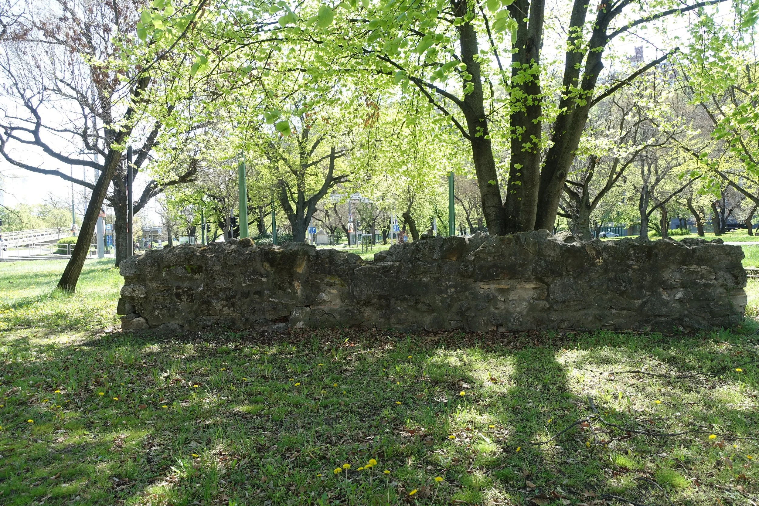
Mediaeval bridge over the árok, retained during the redevelopment of the Tabán district.
The final steps to the confluence with the Danube are covered by a busy riverside road. It’s only possible to get down to this point by detouring further south. The sun was surprisingly warm by this point, and I was ready for lunch. Hungry again! I was back in touristy Budapest with cyclists and scooters hurtling everywhere. I doubted any were aware of the little river that once flowed under them and now only flows, if at all, after torrential rain in the Buda Hills. The Ördög-árok is neither a lost nor a secret river, but for some of its length it is hidden, and increasingly it is failing to be a river at all. Each year sees a drought in the spring here, causing huge concerns to Hungarian agriculture. This year is no exception and will be a subject for discussion at the new Prime Minister's first governmental meeting to be held at a symbolic location deep in the countryside.
The mouth of the Ördög-árok is now a tunnel into the Danube in the centre of Budapest. To the north is the Castle plateau; to the south lies the Gellért Hill. In pre-Christian times it was known as Witches Hill. This may have contributed to the naming of the Devil’s Ditch. The outline of a turreted villa dominates the western Gellért skyline. It’s the former home of Hungarian-born, film director Andy Vajna. This structure looks down on the confluence of the tiny but storied Devil’s Ditch with the mighty Danube. Confluences were considered sacred places in pagan times, and this gothic-looking overhang seems somehow fitting for a river that once ran with so much threat. I clambered up onto Elisabeth Bridge and looked down towards the bankside at the confluence. A couple of youths walked along the sharp-sided concrete bank and stopped to peer into the tunnel. I wondered if they knew they were looking into the jaws of the Ördög-árok.
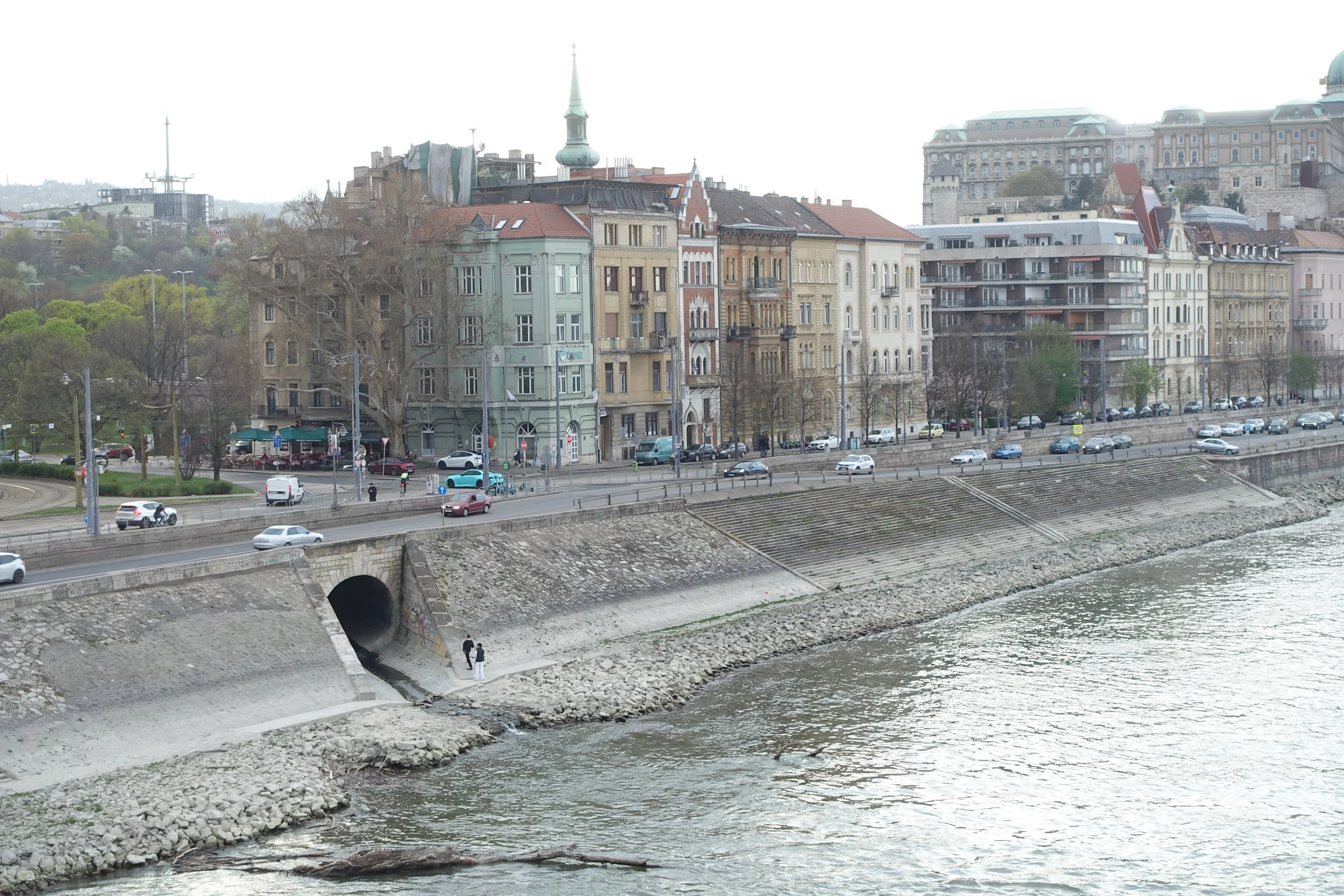
Confluence of the Ördög-árok and the Danube.
For a full and excellent account of the attempted escape through the árok, see The Siege of Budapest: 100 days of WW2 by Krisztián Ungváry. Available in English translation.